
Powerful geointelligence engine
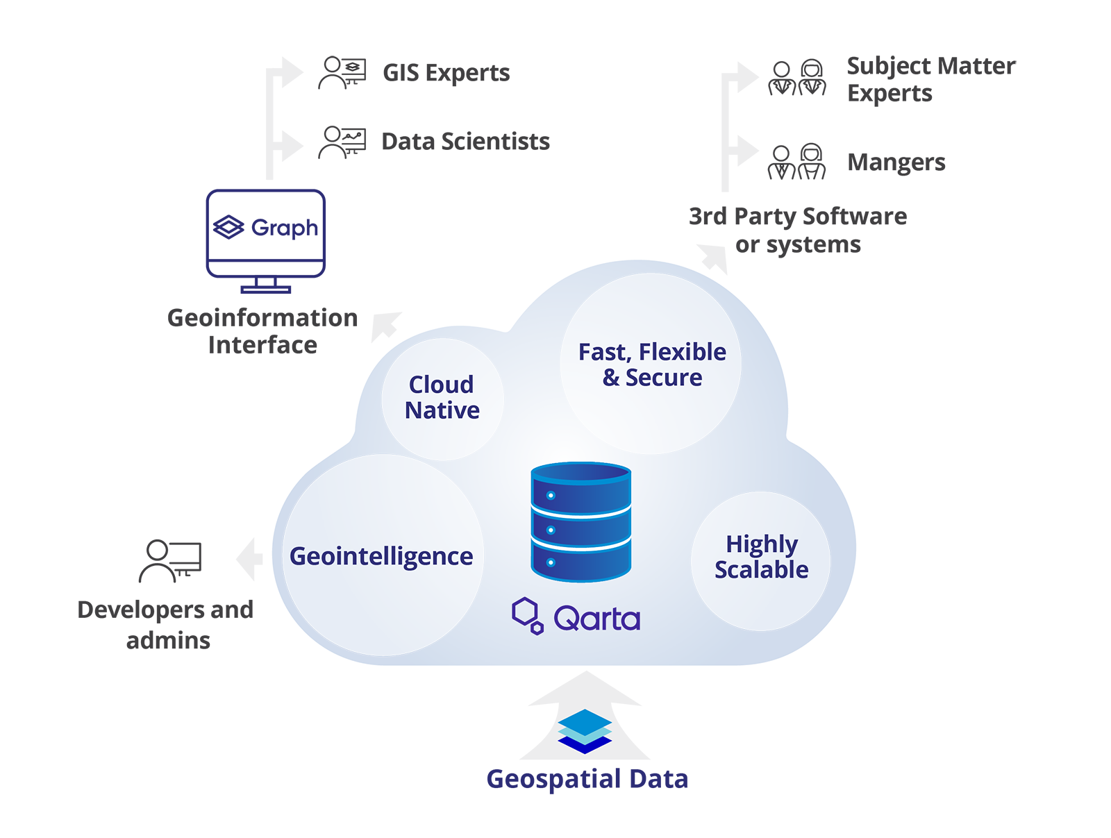
Qarta is a cloud native, highly scalable and powerful geointelligence engine, designed for the purpose of delivering geo content fast, flexible and secure.

Cloud Native

Scalable

Powerful
Qarta is a cloud native, highly scalable and powerful geointelligence engine, designed for the purpose of delivering geo content fast, flexible and secure.
Cloud Native
Scalable
Powerful

According to Quarticle’s Research, Qarta can handle more than 800,000 requests per second, whereas established GIS vendors can reach only 10% or less, worst fail or even crash.
Configurations are flexible and can be automated depending on the platform needs. Qarta integrates Geocoding/Reverse Geocoding from various providers and it comes with a free and open source geocoder from OpenStreetMap.
User and roles management is flexible and easy to use and isolated from the backend mapservers.
Statistics are provided for all operations and users at all times with the integration of Elastic DB and Grafana, Qarta will provide you meaningful insight in your services consumption.

Data transformation from XML received from map servers to JSON or other formats. Data optimization on designated image grid for dynamic and cached vector and raster data images.
Security based on JSON Web Token (JWT) allowing secure connection between our platform and our clients. User security is warranted by the use of signed and encrypted JSON tokens which make the connection to our clients reliable.

According to a Quarticle’s research*, Qarta can handle more than 800,000 requests per second, whereas established GIS vendors can reach only 10% or less, worst fail or even crash.
It can handle more with scalable hardware infrastructure.
If we increase the configuration of the cluster it will be able to process even more requests per second.
* The requests were tested with a cluster of 5 machines. Each machine is a f8_v2 machine.
Qarta Serves all Geoinformation, such as Web Feature Service (WFS), Web Map Service (WMS), Web Coverage Service (WCS), Web Processing Service (WPS), and Web Map Tile Service (WMTS), based on battle-proven GeoServers.
- GeoPlanner in City Administration

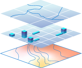
Qarta manages and transforms geospatial information.

Cloud scalability for your Quarter Endings and Monthly Reportings.
Lower Maintenance Costs due to manageability.

Faster Response time for Critical Business Applications.

Transparent and forecastable pricing, based on Usage only. Usage = Number of Requests to Qarta.
Consumption-based Pricing, no Over-Provisioning.

Qarta is a Software-as-a-Service (SaaS) offering, which Quarticle runs for you in your preferred Cloud Provider Environment. Aligned with your Cloud Services spending and budgeting.
We will contact you further.